Call Now!
(531) 213-6659


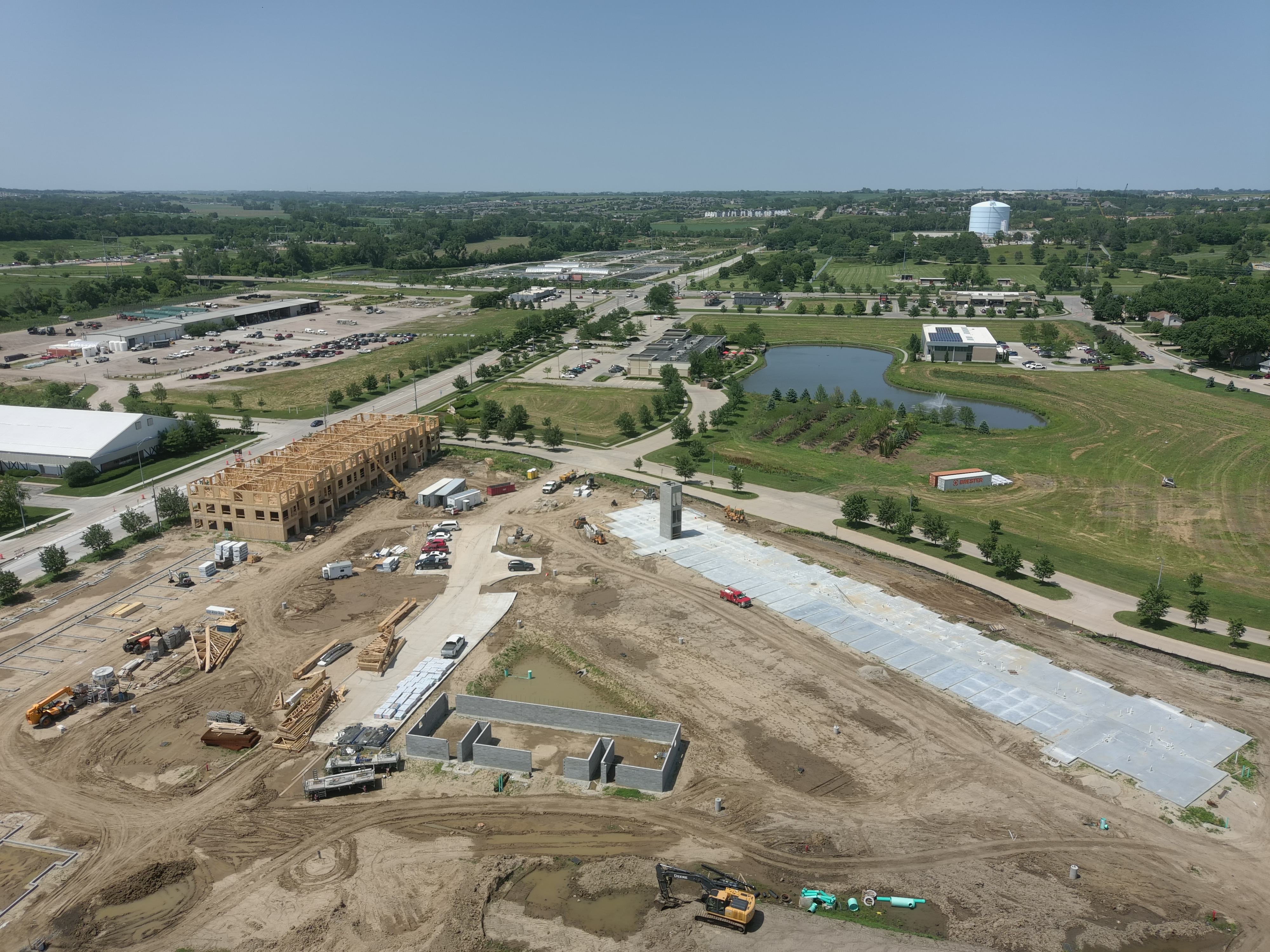
Construction Progression Tracking Benefits
Site Surveying & Progress Tracking:
Drones can capture high-resolution images of construction sites from various angles and heights, providing detailed aerial views. These photos help in surveying the site more efficiently and tracking progress over time, allowing for better project management and decision-making.
Improved Safety and Risk Management:
Using drones for aerial photography reduces the need for manual inspections at height, minimizing the risk of accidents for personnel. By identifying potential hazards and monitoring safety protocols from above, construction companies can enhance on-site safety measures and mitigate risks more effectively.
Enhanced Communication and Collaboration:
Drone photos offer a clear and comprehensive overview of construction projects, facilitating better communication and collaboration among project stakeholders such as architects, engineers, contractors, and clients. Sharing up-to-date aerial imagery helps in aligning expectations, resolving issues promptly, and making informed decisions collectively.
Marketing and Stakeholder Engagement:
High-quality drone photos showcase construction projects in an impressive and visually compelling manner. These images can be utilized for marketing purposes, including project proposals, progress updates, and portfolio presentations. Engaging stakeholders with captivating aerial visuals enhances brand reputation, attracts potential clients, and fosters investor confidence.
Cost and Time Efficiency:
Compared to traditional surveying and inspection methods, utilizing drones for aerial photography is often more cost-effective and time-efficient. Drones can cover large areas in a relatively short time frame, reducing labor costs and minimizing disruptions to construction activities. Additionally, timely aerial insights enable proactive adjustments, optimizing project schedules and resource allocation for improved efficiency and productivity.

Facebook
LinkedIn
Youtube